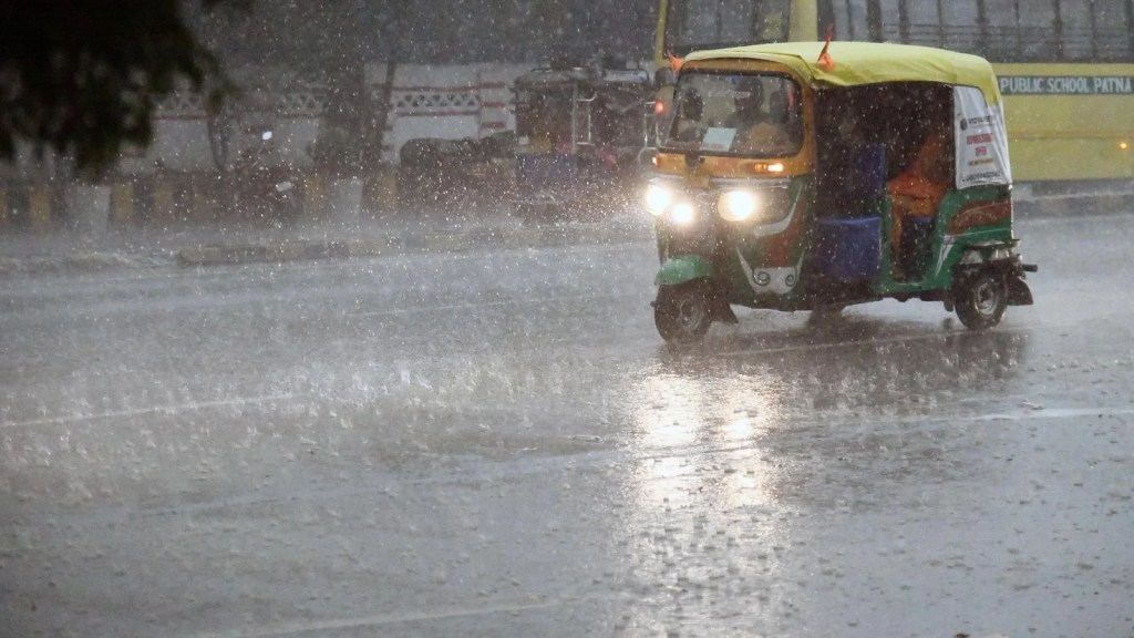
IMD Issues Rain Alert: Thundershowers Expected Across 10+ States from Delhi to Tamil Nadu
Weather Forecast Today: The India Meteorological Department forecasts heavy rainfall across India from May 21-24, 2025, influenced by a cyclonic circulation in the Arabian Sea. Red alerts are issued for coastal Karnataka, with other states like Maharashtra, Andhra Pradesh, and Telangana bracing for thunderstorms. The southwest monsoon is expected to arrive in Kerala soon.

The Indian Meteorological Department (IMD) has issued a widespread rain and thundershower alert for over 10 states across the country. From the northern plains to the southern peninsula and the northeastern hills, several regions are expected to witness moderate to heavy rainfall over the next few days. The sudden shift in weather patterns comes as a result of multiple active weather systems developing over the Indian subcontinent.
This weather activity is expected to not only impact daily life and commuting but also pose challenges to agriculture, particularly in areas where harvesting and post-harvest operations are underway.
Widespread Impact Across Regions
According to the IMD, the following regions are likely to experience significant weather activity:
- Delhi-NCR: The capital region may see thundershowers accompanied by gusty winds. There is a high possibility of waterlogging in low-lying areas, disruption to traffic, and delays in public transportation. Citizens are urged to remain indoors during lightning spells and avoid non-essential travel.
- Uttar Pradesh & Bihar: Eastern Uttar Pradesh and northern Bihar are expected to receive isolated heavy showers. These areas may also experience hailstorms and squally winds reaching speeds of up to 50 km/h. Authorities have advised farmers to secure crops and stay updated with local forecasts.
- Madhya Pradesh & Chhattisgarh: These central states are likely to be hit by intense rainfall spells, especially during the late evening and early night hours. In urban regions, stormwater drainage systems may be tested, and rural areas might experience flash flooding.
- Maharashtra & Gujarat: Vidarbha, Marathwada, and coastal districts of Gujarat will see scattered rain and possible thunderstorms. Power cuts and localized flooding in city areas may occur due to clogged drains and storm runoffs.
- Tamil Nadu & Kerala: Southern districts, especially those in the interiors and hilly terrain, are under watch for heavy rainfall. In Kerala, landslide-prone zones have been marked for monitoring, while in Tamil Nadu, IMD has issued alerts for short bursts of very heavy rain accompanied by thunder and lightning.
- Northeast India: The northeastern states, including Assam, Meghalaya, Nagaland, and Arunachal Pradesh, have been issued an orange alert. Heavy to very heavy rainfall may trigger landslides, disrupt road and rail transport, and raise river water levels. Residents have been advised to avoid travel unless absolutely necessary and to stay away from landslide-prone areas.

Reason Behind the Sudden Rain Activity
The current spell of widespread rain and thunderstorms is attributed to a combination of meteorological phenomena:
- A Western Disturbance is affecting the Western Himalayan region, leading to cloud formation and rain over North India.
- A cyclonic circulation over the Bay of Bengal is pushing moisture-laden winds into the eastern and central parts of the country.
- Strong moisture incursion from both the Arabian Sea and the Bay of Bengal is enhancing convection over peninsular India.
This convergence of systems is expected to continue for the next 3–4 days, intensifying the likelihood of thunderstorms and heavy downpours.
Safety Precautions Issued by IMD
Given the extent and intensity of the expected weather, the IMD has urged citizens to observe the following precautions:
- Avoid taking shelter under trees during lightning strikes.
- Secure loose outdoor items that could become hazards in gusty winds.
- Refrain from traveling during heavy rain unless necessary.
- Farmers should avoid harvesting or drying crops in open fields and store produce in covered areas.
- Check weather updates regularly and follow official advisories.
Looking Ahead: Is This a Sign of Early Monsoon?
While pre-monsoon showers are not uncommon in late May, the current intensity of rainfall across such a large swath of India is notable. Meteorologists suggest this activity is helping prepare the atmosphere for the eventual onset of the southwest monsoon, which typically begins in Kerala around June 1.
Although this is not the official monsoon onset, the early rain spells are crucial for replenishing groundwater levels, reducing surface temperatures, and helping in the initial sowing of kharif crops. IMD will monitor and announce the formal onset of the monsoon in the coming days.
Final Thoughts
With intense weather activity expected across a wide swath of the country, citizens are urged to stay updated with local forecasts and advisories. The IMD continues to monitor the situation and will issue timely warnings as needed.
These rain alerts underscore the need for climate resilience and improved infrastructure to withstand unpredictable weather patterns. From farmers to daily commuters, the coming days will test preparedness at multiple levels. Stay safe, stay informed, and take necessary precautions as India navigates this stormy spell.
Stay tuned for more updates on weather developments, safety measures, and regional forecasts.


